

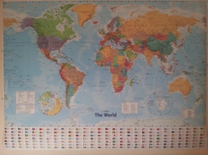
Enormous poster of the world.
As I mention in the about page one of the key motivators for getting Go Cotswolds off the ground is my fascination with travel.
I love the idea of exploring different parts of the world and the idea of showing off a very small part of it that I know – The Cotswolds – to people that don’t is something that excites me.
The world fascinates me. It’s enormous yet relatively accessible with modern travel and I often find myself gawping at the enormous poster of the world in the office thinking of where I’d like to go.
Something that whilst on a call earlier I was doing once again.
The thing I find is that if you look at a map of the world for even a small period of time you’re almost guaranteed to find somewhere you’ve never heard of (unless your an expert geographer of course).

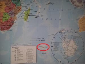
The Kerguelen Islands – circled in red
Which led me to the Kerguelen Islands. Heard of them? No, nor me.
It’s essentially a group of islands (the largest of which is roughly the size of Cumbria) part of the French Southern and Antarctic Lands in the South Indian Ocean.
It’s nicknamed Desolation Island due to it’s remoteness.
The average temperature in the height of summer is a lofty 11°C and all bar a group of 50-100 scientists and a job lot of seals it’s uninhabited.
However, if you fancy visiting they do welcome tourists. About 30 a year in fact.
Unfortunately, the only way to get there is by boat – which appears to take 28 days from the French Island Reunion.
Not very accessible even with modern travel.
I’ve been very fortunate to go to some places relatively far from home but I can’t say I’ve ever been anywhere quite as remote as that.
Kerguelen Islands on Google Maps
https://www.google.co.uk/maps/@-49.2038781,69.3836054,130302m/data=!3m1!1e3